Barra da Kwanza
Edit SpotAbout
Definately worth the detour on a west swell for the rare pleasure of surfing rights. Easily blown out by afternoon winds.
Atmosphere:
An isolated spot, overlooked by a military outpost on the cliff top - too close to the rivermouth to be really comfortable from the point of view of sharks.
Additional Info:
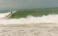
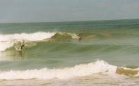
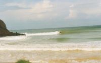
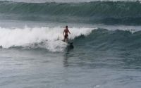
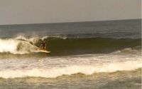
Three spots are surfable here, all of them lined up under the multi-coloured cliffs. The first two are small point/beach breaks which are OK but not worth the detour.
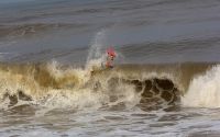
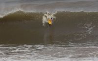
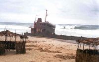
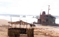
The third is the main location as it is a form of submerged rocky reef running straight out under the main cliff at its highest point. The reef breaks both right and left, with the right being slightly more hollow and shorter. In big swells this closes out completely. This is the only place I ever surfed a right in Angola (except the shipwreck on west to NW swells).
Location
Loading...Access
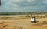
Two possibilities: Cross the Kwanza Bridge into the National Park of Quisama (80km south of Luanda) - see the 'Cabo Ledo' spot for details of this particular pleasure. About 1km after the bridge, at the end of the obvious flood plain, take a dirt track west (right) along the mud-flats through the grasslands down to the beginning of the rivermouth sand-spit, which extends 2km northwards. Park here and make your way along the seashore south (easier at low tide).
Alternatively, 500m before the bridge, turn right and follow the signs to the restaurant on the river front (a slightly surreal experience - but good food and a very chilled place to hang out). From here get a boat to take you across the river - you will end up pretty close to the foot of the cliffs where you would park, had you driven. This route is quick and easy - make sure you arrange a pick-up, as it would be a bad idea to try and paddle back across (sharks and crocs)... However, this method means that you have entered the national park of Quisama - illegally. Any confrontation with police,soldiers,park guards etc could prove costly and time consuming. Best to get a ticket first at the bridge!
| Walk | Short walk (5-15 min) |
|---|---|
| Public access | Unknown |
| 4x4 required | Yes |
| Boat required | No |
Wave Characteristics
| Type | Reef (rocky) |
|---|---|
| Direction | Right and left |
| Bottom | Flat rocks with sand |
| Power | Fast, Fun |
| Frequency | Don't know |
| Normal length | Short (<50m) |
| Good day length | Short (<50m) |
Ideal Conditions
| Wind direction | North, East, NorthEast |
|---|---|
| Swell direction | West, SouthWest, South |
| Swell size | 3ft-5ft - 8ft+ |
| Tide | Low and mid tide |
| Tide movement | Rising tide |
Crowd
| Week | Empty |
|---|---|
| Weekend | Empty |
Dangers
Rocks, Sharks, Mines (Angola only !)
Videos
None
Nearby spots
12.61 miles away
| Direction: | Left |
| Bottom: | Sandy with rock |
| Frequency: | Regular (100 days/year) |