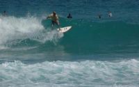
Sprat Bay
Edit SpotAbout
No spot description.
Location
Loading...Access
Take a $3.00 ferry ride from sub base St.Thomas to Water Island(U.S.V.I.'s 4th and newest island)
its a 5 min ride, from the dock walk the road about 1mile or try hitch a ride all the way to the east end of the island, you will be at the beach of sprat, paddle about 10 min out to the point, and surf.
| Walk | Long walk (>30 min) |
|---|---|
| Public access | Yes |
| 4x4 required | No |
| Boat required | Yes |
Wave Characteristics
| Type | Point break |
|---|---|
| Direction | Right |
| Bottom | Reef (coral, sharp rocks etc.) |
| Power | Hollow, Fast, Ledgey |
| Frequency | Sometimes breaks (50 days/year) |
| Normal length | Normal (50 to 150m) |
| Good day length | Long (150 to 300m) |
Ideal Conditions
| Wind direction | North, NorthWest, NorthEast |
|---|---|
| Swell direction | SouthWest, South, SouthEast |
| Swell size | Less than 3ft - 6ft+ |
| Tide | Mid and high tide |
| Tide movement | Rising tide |
Crowd
| Week | Empty |
|---|---|
| Weekend | Few surfers |
Dangers
Urchins, Rocks, Sharks
Videos
None
Nearby spots
Hull bay
5.28 miles away
| Direction: | Right and left |
| Bottom: | Reef (coral, sharp rocks etc.) |
| Frequency: | Don't know |
Turner Bay
9.75 miles away
| Direction: | Left |
| Bottom: | Reef (coral, sharp rocks etc.) |
| Frequency: | Rarely breaks (5 days/year) |
Tortola - Apple Bay
17.64 miles away
| Direction: | Right |
| Bottom: | Reef (coral, sharp rocks etc.) |
| Frequency: | Regular (100 days/year) |


